Stamp River Fishing Report Fall 2022
Stamp River Chinook & Coho in Season
The Chinook run this fall has been one of the best resembling the 80s and early 90's similar to the huge run in 2021. With an epic Chinook run underway all sectors are having bonus access to abundant hatchery surpluses bound for the Stamp River.****Update Oct 7 2022**** - Stamp/Somass rivers remain open. This system has managed water levels with dams that have adequate water supplies for Salmon and other fish in the system. They are exempt from the Region 1 Vancouver Island drought conditions temporary closure.
Variation Order: 2022-RCT-466
Effectively 00:01 hours October 8, 2022, until further notice, there is no fishing for salmon in the Region 1 (freshwater) systems on Vancouver Island, with the following exceptions:
Campbell River; Puntledge River and Courtenay River; Little Qualicum River; Qualicum River; Stamp River; and Somass River.
****
Following please find a detailed report including:
- Run Size
- Historical Timing
- Environmental Conditions
- Regulations
- DFO In Season update (Full PDF Download)
- Our Services - Full Packages, Afternoon Charters or Day Trips
We are running both gear and fly fishing trips daily. Lets Go!
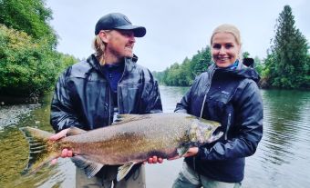
 photo credits Anders Bo Jensen and Super Model Linnea
 |
 |
Run Size:
AREA 23 CHINOOK PRE-SEASON EXPECTATIONS
Somass/Robertson Creek Hatchery Chinook
The forecast terminal return of adult Stamp/RCH Chinook to Barkley Sound and Alberni Inlet in
2022 is approximately 135 000 (range: 100 000–170 000). The predicted adult age composition
is 36%, 54% and 11% of 3, 4, and 5-year-old fish, respectively). With the pre-season forecast in the
“Abundant” category, the fishing season opened with directed Chinook fisheries in the Alberni
Inlet area for all sectors.

The River fishery remains strong and we are only part way through the season. We look forward to more strong weeks ahead.
HISTORICAL RUN TIMING Vs ACTUAL


ENVIRONMENTAL CONDITIONS

REGULATIONS
DFO Online Linkwww.pac.dfo-mpo.gc.ca/fm-gp/rec/fresh-douce/region1-eng.html (scroll down to Somass River)
- All retained chinook and sockeye must measure 30 cm or more from tip of nose to tail fork, and all coho must measure 25 cm or more.
- An "adult chinook" in Region 1 is defined as being over 50 cm.
| Somass River | All | June 1 to Aug 24 | Bait ban | |
| Except in those areas and times listed below | Chinook | Aug 25 to Dec 31 | 2 per day, 1 of which may be more than 77cm in length. | |
| Coho | Aug 25 to Dec 31 | 2 per day | ||
| Approximately 200 meters above and 150 metres below the island near the boat launch at Somass Park near Service Road. | Sockeye | July 5 until further notice | No retention of sockeye. FN0620 |
|
| From the tidal boundary at the Papermill Dam to white triangular fishing boundary signs approximately 0.5 km upstream (Falls Road Gravel Pit and the southernmost end of Collins Farm/Arrow Vale Campground-Hector Road). | All | Aug 25 to Nov 15 | Finfish closure | |
| Somass River tributaries | All | May 1 to Oct 31 | Bait ban. | |
| Sproat River | All | May 1 to Oct 31 | Bait ban | |
| All | Apr 1 to Mar 31 | No retention of salmon. | ||
| Sproat River from Sproat Lake to fishing boundary signs approx. 300m downstream of Hwy 4 | All | Jun 15 to Nov 15 | Finfish closure | |
| Stamp River | Except in those areas and times listed below | |||
| Chinook | Aug 25 to Dec 31 | 2 per day, 1 of which may be more than 77 cm. in length | ||
| Coho | Aug 25 to Dec 31 | 2 per day | ||
| From the confluence of the Ash River upstream to the Great Central Lake Dam | All | Jan 1 to Apr 30 | Finfish closure | |
| Between fishing boundary signs approximately 200m upstream of and 500m downstream of Stamp Falls | All | June 15 to Nov 15 | Finfish closure | |
| Hatchery Lagoon - from boundary signs on either side of the Stamp River located at the inlet of the Stamp River hatchery lagoon continuing downstream approx. 250m to the cable car crossing | All | Aug 25 to Oct 31 | Finfish closure | |
| Powerline Crossing - from boundary signs on either side of the Stamp River at the powerline crossing downstream approx. 500m to boundary signs on either side of the Stamp River located at the inlet of the Stamp River hatchery lagoon. | All | Oct 1 to Oct 14 | Finfish closure | |
| Upstream of signs located at Girl Guide Falls approximately 250m upstream of the Beaver Creek and Stamp River confluence | All | Apr 1 to Mar 31 | Bait ban | |
| Downstream of signs at "Girl Guide Falls" approximately 250m upstream of the mouth of Beaver Creek. | All | Jun 1 to Aug 24 | Bait ban | |
| Stamp River tributaries | All | May 1 to Oct 31 | Bait ban. |
The River fishery remains strong and we are only part way through the season. We look forward to more strong weeks ahead.
Lets Go!

Fall Salmon & Steelhead Fish-Lodge-Dine
1 Night Lodging & 1 Day fully guided fishing. Breakfast, Lunch, Gourmet Dinner, Fish Care . Stay as many days that fit your schedule! Trip Details »
Salmon & Steelhead - Guided Day Trips
1 Day Guided Fishing for Chinook, Coho and depending on the timing possibly Steelhead. Stamp Somass River System Trip Details »